The plan at a glance
This is Anudeep’s personal, detailed version of the trip. It complements the shared itinerary; where bookings, flight times, or live road conditions differ, the confirmed group booking and same-day official alert should win. Both flights are booked: out on Aug 8 (DL2534 SAT 7:30 AM → LAX, DL1045 LAX 12:07 PM → SEA 2:50 PM) and home on Aug 15 (DL2568 LAX 10:59 AM → SAT 3:59 PM).
Booking tracker
Everything that must be reserved, modified, or verified — in the order it bites.
| Status | Booking | Used on | Notes |
|---|---|---|---|
| URGENT — today | Ashford / Elbe room or campsite | Night of Sat Aug 8 | Rainier gateway on an August Saturday — book immediately. Campsite fallback: Cougar Rock inside the park. |
| URGENT — today | Hertz reservation modification | Aug 8–15 | Picked up SEA ~3:45 PM Aug 8. UPDATED: drop LAX Friday Aug 14 by 9 PM (7 days — verify adjusted total). All 3 drivers on the contract (under-25 surcharge applies). |
| Verify now | Mount Rainier timed-entry reservation | Sun Aug 9, pre-7 AM | Early entry has historically been exempt — confirm the 2026 rules on nps.gov and grab a reservation if required. |
| Reserve | Fern Canyon day-use reservation | Tue Aug 11 | Free permit (May 15–Sep 15 rule) via Redwood Parks Conservancy, plus $12 cash at the kiosk. |
| Booked | Elkhorn Slough otter kayak | Wed Aug 12, 3–5 PM | Moss Landing launch. Reconfirm the window and arrive early for parking (~$10). |
| Reserve | Malibu surf lesson — Surfrider | Fri Aug 14, 10 AM–12 PM | ~$90/person, wetsuit and board included. Book for Aug 14. |
| Reserve | Rooms for nights 3–7 | Aug 10–14 | EUREKA CA tonight (Aug 10) — arriving near midnight, so book a chain with a 24-HOUR FRONT DESK and call with your ETA. Then FORT BRAGG (Aug 11) · Salinas — NOT Monterey (Aug 12) · Pismo Beach (Aug 13) · El Segundo/Inglewood near LAX with an airport shuttle (Aug 14). Garberville night cancelled. |
| Booked | Flights, both directions | Aug 8 + Aug 15 | Out: DL2534 SAT 7:30 AM → LAX 8:33, DL1045 LAX 12:07 PM → SEA 2:50 PM. Return: DL2568 LAX 10:59 AM → SAT 3:59 PM. |
The 2026 watchlist
These claims shape the schedule but must be verified against the linked official sources before departure.
Rainier timed entry
Pre-7 AM entry at the Nisqually gate has historically been exempt from timed-entry windows. Verify the 2026 rules on nps.gov. $30/vehicle (or an America the Beautiful pass). Grove of the Patriarchs remains closed from 2021 flood damage — do not detour for it.
Big Sur traffic control
Highway 1 is open, but Rocky Creek Bridge has 24/7 one-way signal control through Aug 31 with delays up to ~15 minutes. Check Caltrans QuickMap on the morning of Day 6.
Monterey Car Week
The trip overlaps Aug 7–16, 2026. That is why the plan sleeps in Salinas and clears the Monterey/Carmel area early on Day 6. Verify the event calendar.
Fern Canyon reservation
A free day-use reservation is required for Aug 11 (May 15–Sep 15 season) plus $12 cash. Confirm current release rules with the Redwood Parks Conservancy. Davison Road is narrow dirt with stream crossings.
McWay Falls access
The overlook trail is expected to remain closed through 2026. Use only the legal viewing area shown by California State Parks.
Ecola State Park
Reopened April 2026 after landslide repairs — check current advisories before relying on the Day 3 opener.
The full route
Use the shared interactive map for the geographic overview; each day below has a focused directions link.
If the embedded map does not load, open the full route map or use the per-day Google Maps links below.
The eight-day plan
Open a day for the full timeline, stops, cash and fuel calls, and cut-if-late rules.
1Land SEA → Seattle → the Rainier gate
Sat Aug 8 · land 2:50 PM · car ~3:45 · Ashford ~10:15 PM · ~100 miles
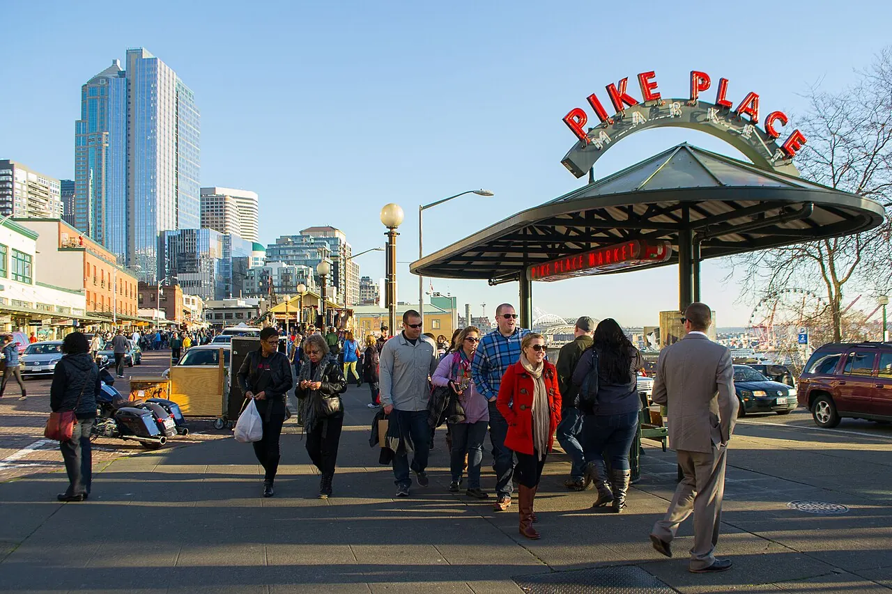
DL1045 lands at 2:50 PM — go straight to the Hertz counter; there’s no car-less downtown window anymore. Wheels by ~3:45, downtown by ~4:15. That leaves roughly three golden-hour hours in Seattle before the two-hour run to Ashford. Kerry Park at sunset is the anchor; everything else flexes around it.
- 2:50
Land at SEA, pick up the Hertz car
Bags, then the rental counter. Confirm the modified contract (drop LAX ~7:30 AM Aug 15), the under-25 surcharge, the toll policy, and all three approved drivers.
- ~4:30
Pike Place Market — park once
Use the Pike Place garage and walk everything downtown from here. Produce stalls wind down after 5, but the market, Pike Place Chowder, Piroshky Piroshky, and the gum wall are still going.
- ~5:30
Waterfront + Seattle Great Wheel
Straight downhill from the market on the rebuilt waterfront promenade. The 175-ft wheel over Elliott Bay runs ~12 minutes in enclosed gondolas (~$20) with big Sound-and-skyline views.
- Optional
Space Needle or Chihuly Garden & Glass · ~$40
5 minutes from the market — only if you’re ahead of schedule. Chihuly next door is the better value. Kerry Park at sunset matters more than either.
- ~7:30
Kerry Park — the Seattle postcard
Skyline, Elliott Bay, and — on a clear evening — Mount Rainier floating behind the city. You’ll be standing on its summit road tomorrow. Free, 5 minutes from downtown. Sunset ~8:25 PM; leave by 8 to make Ashford at a sane hour.
- Night 1
Sleep in Ashford — the Rainier gate
~2 hours from downtown, arriving ~10:15 PM. Ashford/Elbe motels and cabins sit 6 miles from the Nisqually entrance — book now, it’s an August Saturday. Campsite alternative: Cougar Rock inside the park. Grocery-stop tonight: breakfast food, trail lunch, and hike snacks — nothing opens before 7 AM tomorrow.
2Mount Rainier → the Oregon Coast
Sun Aug 9 · gate 6 AM · leave park ~5:30 PM · ACTUAL: stopped in Kelso, WA · ~130 miles
In before 7 AM: historically exempt from timed-entry windows (verify 2026 rules on nps.gov), no line, first light on the mountain, and a parking spot at Paradise before the lot fills. Cell service in the park is near zero — offline maps must already be downloaded. The evening constraint is just as hard: leave the park by ~5:30 PM; 7 PM is the absolute ceiling, and that’s already a midnight-ish coast arrival.
- 6:00
- ~6:30
Christine Falls
69-ft falls framed by a stone bridge, steps from the pullout. Classic quick shot on the climb to Paradise — 10 minutes.
- 6:45
Narada Falls
168-ft curtain waterfall; the short, steep path to the base viewpoint catches rainbows in the mist. 15 minutes.
- 7:15–1
Paradise — the Skyline Trail
The best day-hike in Washington: a 5.5-mile loop climbing ~1,450 ft to Panorama Point, staring straight at the glaciers. August means peak wildflowers and marmots everywhere.
- Carry: layers and plenty of water — Paradise is 5,400 ft and weather flips fast.
- Snowfields linger into August: stay on trail.
- Short option: Skyline to Myrtle Falls — 1 mile, nearly flat, still a postcard.
- 1:30
Reflection Lakes
The mirror shot of Rainier, right off Stevens Canyon Rd, 10 minutes past Paradise. Calmest water midday-ish; then backtrack out the Nisqually gate.
- 5:30
Leave the park → dinner in Astoria
~3.5–4 hours, 175 miles to the coast via Astoria. If you’re on time, dinner at Fort George ~8:30 PM — restaurant side only; everyone is under 21. The last stretch is dark, just cruising.
- Night 2
ACTUAL: Quality Inn, Kelso WA
The night actually ended at the Quality Inn in Kelso (I-5 exit 39) instead of Seaside/Cannon Beach — no Astoria dinner, no midnight coast driving. Right call. The coast is ~2 hr away via the Lewis & Clark Bridge and US-30 through Astoria; Day 3 is replanned to start from here.
3Oregon speed-run → Eureka, California
Mon Aug 10 · 9 AM Kelso · ~11:45 PM Eureka · ~490 miles · the big push
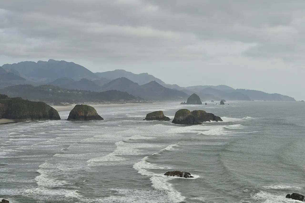
The goal changed: get into California tonight so tomorrow is entirely the Mendocino coast. That means roughly ten hours of driving with about four and a half of them after dark past Coos Bay. Samuel Boardman is the casualty — you drive straight through it around 9 PM and see nothing. Two non-negotiables: swap drivers at every single stop, and treat Crescent City as a real bail-out, not a failure. The 2–4 AM window is the most dangerous stretch of clock for drowsy driving; if you are anywhere near it, stop there. It costs 90 minutes tomorrow morning and nothing else.
- ✅ 11:15
Cannon Beach — Haystack Rock
Done. The one North Coast stop that made the cut.
- ✅ 1:00
Tillamook Creamery
Done — free factory tour and food-hall lunch, out by 1:50.
- 4:15
Cape Perpetua — Thor’s Well · 30 min
🅿️ Gravel turnout at the Cook’s Chasm bridge, west side of 101 — the well is a five-minute path from there. This is the first thing to cut tonight: dropping it puts you in Eureka half an hour earlier, and half an hour matters at midnight.
- 5:00
Heceta Head — 10-minute photo
🅿️ Ocean-side turnouts on 101 just south of the Sea Lion Caves building. Photo, back in the car.
- 6:40
Coos Bay — dinner, full tank, driver swap
The last real stop before the haul. Eat fast, fill the tank, use the bathroom, buy coffee, change drivers. Out by 7:15. From here it is about four and a half hours to Eureka in the dark.
- ~9:15
Brookings — last Oregon fuel
Ten minutes, top off, swap drivers again. Samuel Boardman is the black stretch just north of here.
- ~10:30
⚠ Crescent City — the bail-out
Motels along US-101 through town. If the driver is fighting sleep and the backups are asleep, this is the stop. You lose 90 minutes of tomorrow and gain everything else.
- Night 3
Eureka, California — arrive ~11:45 PM–12:30 AM
Book it now and call ahead. Arriving near midnight, most small motels have already locked the office — pick a chain with a 24-hour front desk on Broadway or 4th St (Motel 6, Super 8, Quality Inn, Red Lion) and tell them your ETA. Sleep in; tomorrow starts at 9.
4Redwoods → Hwy 1 all the way → San Francisco
Tue Aug 11 · 9:30 AM Eureka · Bodega Bay sunset · SF ~9:45 PM · ~430 miles
Cutting inland at Fort Bragg would have saved about two hours of driving — but that time would have been spent parked at a Marin viewpoint waiting for the sun to go down anyway. The real cost of staying on Highway 1 is 30–60 minutes of hotel arrival, and it buys ninety miles of the best coastline in Northern California at golden hour. The Golden Gate isn’t lost either: you walk across it tomorrow morning. The one hard requirement is fuel — fill up in Fort Bragg, because the next ninety miles of Highway 1 have almost no stations.
- 9:30
Gas in Eureka, then go
Broadway/US-101 at the south end of town. Water and snacks. Next cheap gas is Garberville, two hours south. Roll by 9:40.
- 10:25
★ Avenue of the Giants — Founders Grove · 1 hr · free
Exit 101 at Pepperwood and drive the full 31-mile Avenue instead of rejoining the freeway — the road itself tunnels through 300-foot coast redwoods, which is the drive-through-redwoods experience. At Founders Grove, a flat half-mile loop takes you past the 346-ft Founders Tree and the Dyerville Giant: 362 feet, fell in 1991, now lying along the trail with a root ball thirty feet tall. Walking its length is the only thing that makes the scale land.
- 11:50
Garberville — lunch + fuel · out by 12:30
Eel River Cafe: grilled cheese or a veggie omelet for the vegetarians, chicken sandwich or tuna melt for the other two. Cheap gas — top off here.
- 12:55
Chandelier Drive-Thru Tree, Leggett · $15/car · 15 min
A living coast redwood roughly 276 feet tall and 21 feet thick, with a 6×9-foot hole cut through the base in the 1930s. You drive the car straight through it.
- 1:10–2:50
★ Leggett Hill — where Highway 1 begins
Highway 1 leaves 101 here and corkscrews about 25 miles over the coast range: hairpins through redwood and fir, over a summit, then the descent where the Pacific opens up near Rockport — that first ocean view is the moment. After it, 35 miles of open coastal terrace past Westport. 35–45 mph and the best driving of the trip. Carsick-prone rider up front.
- 2:50
★ MacKerricher State Park — Laguna Point · 45 min · FREE
No entry kiosk. A short boardwalk runs out over the headland to a harbor seal haul-out — usually dozens of seals piled on the rocks directly below, close enough to hear. Tide pools at the base, and the old Haul Road (a former logging railroad grade) runs flat along Ten Mile Beach. The one wildlife stop of the day.
- 3:40
Glass Beach + ⚠ FILL THE TANK · 25 min · free
Lot at the end of Glass Beach Dr off W Elm St, five minutes from Laguna Point. The town dumped its trash off this cove from 1906 to 1967 and the surf tumbled the glass and pottery smooth. Reality check: it has been picked over for decades, so expect scattered pieces rather than a carpet — and collecting is illegal, it’s inside MacKerricher. ⚠ Fuel up in Fort Bragg before heading south.
- 4:35
Mendocino Headlands · 20 min · free
A village that looks like coastal Maine, wrapped on three sides by free state-park bluff trail with sea arches and blowholes. Park on Main St, walk to the edge, grab coffee for the road, go.
- 5:00–6:15
★ Elk · Point Arena · Gualala — golden hour
Not a stop, the drive. Open cliff above the Pacific with sea stacks straight offshore at Elk, then Point Arena and down into Gualala with the sun dropping the whole way. Free turnouts constantly — pull over wherever it looks good.
- 6:15–7:45
★ Sea Ranch → Stewarts Point → Jenner — the best stretch
Past the Sea Ranch’s weathered-timber architecture the road narrows onto true cliff-edge above the surf all the way to Jenner, where the Russian River meets the ocean and harbor seals haul out on the sandbar. The overlook just north of town is spectacular in low light.
- 7:50
★ Bodega Bay — SUNSET ~8:05
Bodega Head, the headland west of town, is the best free viewpoint; Doran Beach also works. This is also Hitchcock’s Birds town — the schoolhouse is up the hill in Bodega proper. After sunset, cut inland through Valley Ford and Petaluma to US-101: rolling farmland and easy highway, no cliffs in the dark.
- Night 4
San Francisco — check in ~9:45 PM
Book from the road so you drive straight there instead of hunting. South San Francisco, Daly City and Millbrae are the cheap chain belt with free parking; downtown lots run $50+ a night. ⚠ Bring everything inside — smash-and-grab break-ins are relentless here.
5San Francisco morning → Otter Kayak → Salinas
Wed Aug 12 · SF 9:30 AM · Moss Landing 3 PM · Salinas ~6 PM · ~130 miles
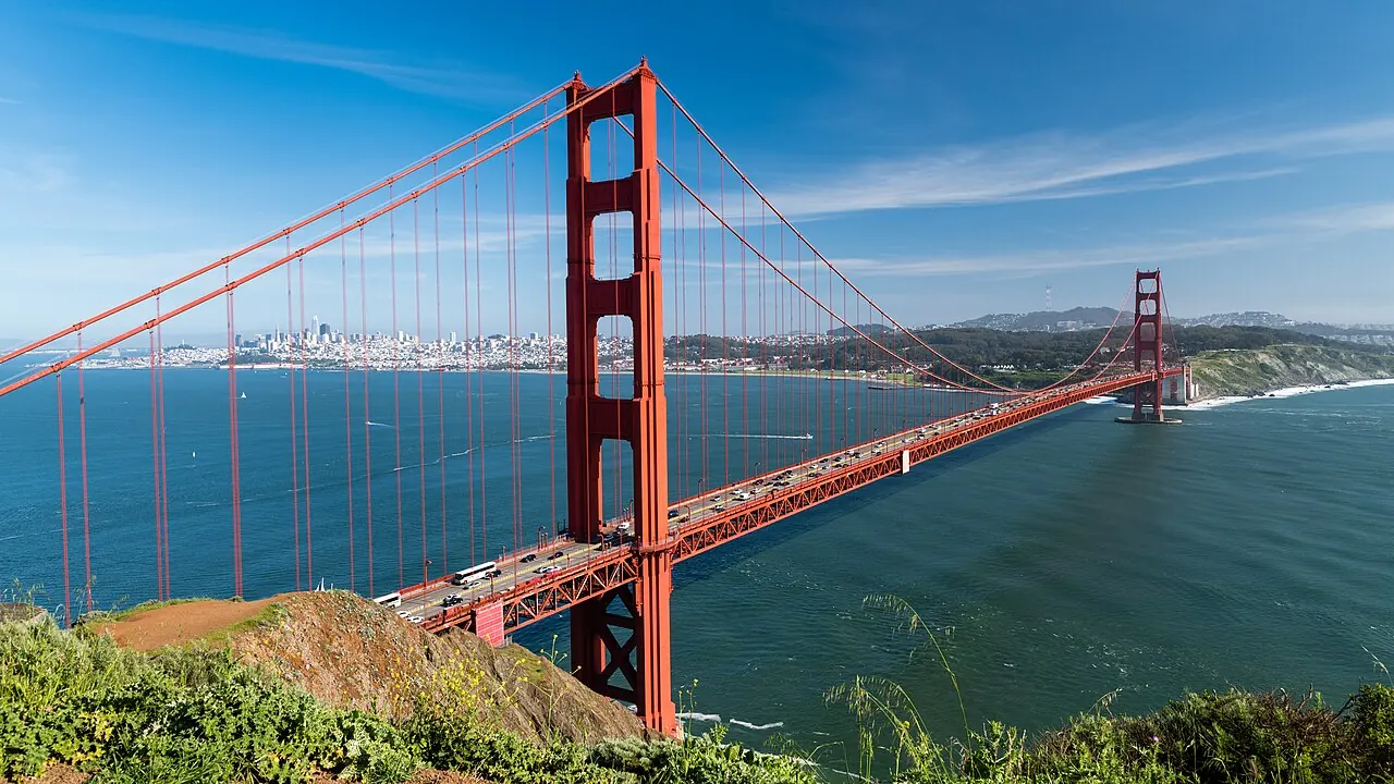
Only about 130 miles. The one fixed point is the 3 PM launch at Moss Landing, which is an hour and forty-five minutes south of the city — so the whole morning is free as long as you are rolling by 1:15. Sleeping in Salinas tonight rather than the Bay Area is what keeps tomorrow’s Big Sur day civilised: a 6:45 start instead of a 6:00 sprint.
- 9:30
Lands End + Sutro Baths · free
Free lot at the Lands End Lookout. The best free morning in the city: the ruins of the 1896 Sutro Baths — a vast seawater swimming palace that burned in 1966, and you walk through the concrete shell — then the Lands End cliff trail with the bridge framed by cypress. ⚠ A notorious break-in lot; empty the car.
- 11:15
★ Walk the Golden Gate Bridge · free
Park at the Welcome Center on the San Francisco side and walk out onto the span. It is 1.7 miles across, but going out fifteen or twenty minutes and turning back is enough — you are 220 feet above the water and the deck moves under the traffic.
- 12:30
Lunch — Mission burritos or the Ferry Building
Mission District taquerias for a huge cheap burrito (vegetarian options everywhere — confirm the beans have no lard), or the Ferry Building marketplace if you would rather be on the water. Roll by 1:15.
- 3:00–5:00
🌊 Elkhorn Slough kayak, Moss Landing · ~$50pp
The densest sea otter population in California. Flat protected water, no surf and no cold-shock risk — otters, harbor seals and pelicans within feet of the boat. Check in at 2:40. ⚠ Confirm the booking.
- Night 5
Sleep in Salinas — not Monterey
Arrive around 6 PM. Twenty minutes inland and cheap; Monterey is sold out and $500+ for Car Week. Fill the tank tonight — Big Sur gas is scarce and Ragged Point prices are brutal.
6The Big Sur Signature Drive
Thu Aug 13 · Salinas → Pismo Beach · 8:30 AM–7 PM · ~250 miles
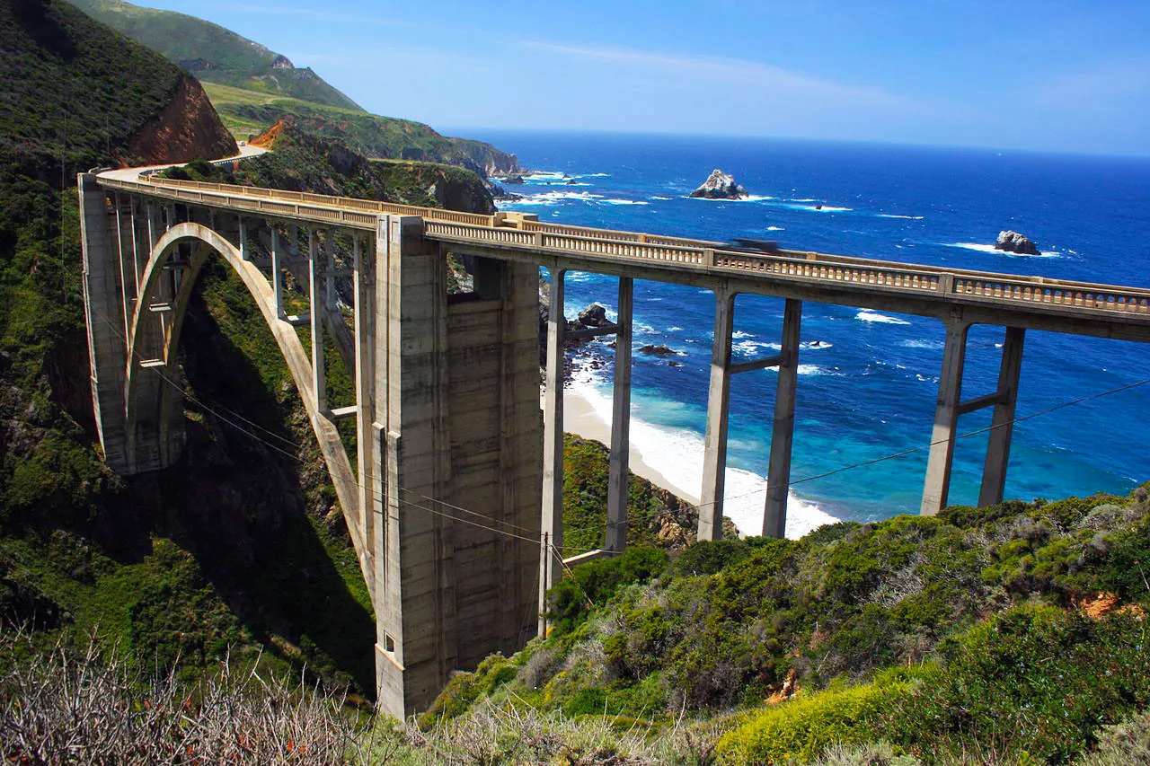
Check QuickMap at breakfast: Rocky Creek Bridge runs 24/7 one-way signal control through Aug 31 (≤15-minute delays), and any confirmed closure outranks this plan. Big Sur is also a cell dead zone — offline maps on before leaving Salinas.
- 8:30
Point Lobos · ~$10/vehicle
Cypress Grove and Bird Island loops at the north gateway to Big Sur. The small lot fills fast — arrive early. China Cove is stunning. No swimming.
- 10:15
Garrapata State Park — Soberanes Point
Unmarked turnouts (numbered gates 13–19) and empty bluff trails: the Big Sur hardly anyone stops for.
- 11:00
Bixby Creek Bridge
The most-photographed bridge on the coast. Use the marked turnouts; expect the Rocky Creek one-way delay just north (≤15 min).
- 12:00
Pfeiffer Beach · $12 CASH only
Purple-tinged sand and the Keyhole Arch. Narrow Sycamore Canyon Road near Big Sur Station; small lot, wind, rip currents — photos, not swimming.
- 1:30
- 2:45
McWay Falls
80-ft waterfall onto a cove beach. The overlook trail is closed through 2026 — view from the legal roadside area only.
- Optional
Sand Dollar Beach, Jade Cove + Ragged Point
Big Sur’s longest beach, the cove where washed-up jade hides in the rocks at low tide, and the last big cliff pullout with café, restrooms, and emergency-priced gas. All free; ~30 + 20 minutes.
- 3:45
Piedras Blancas elephant seals · free
Hundreds of elephant seals on the beach from a free boardwalk — better value than a Hearst Castle tour, which this plan deliberately skips.
- 5:30
Morro Bay — Morro Rock + dinner
A giant volcanic plug rising from the bay; fish and chips on the Embarcadero. (This is also the backup otter-kayak spot if Elkhorn fell through.)
- Night 6
Sleep in Pismo Beach
Arrive ~7 PM. Beach town, cheap motels, and it shortens tomorrow morning’s run to Malibu. Walk the pier at sunset (~7:55 PM).
7Surf Malibu → Swim Santa Monica → Griffith Sunset
Fri Aug 14 · Pismo → LAX · 7 AM · car back 9 PM · ~215 miles
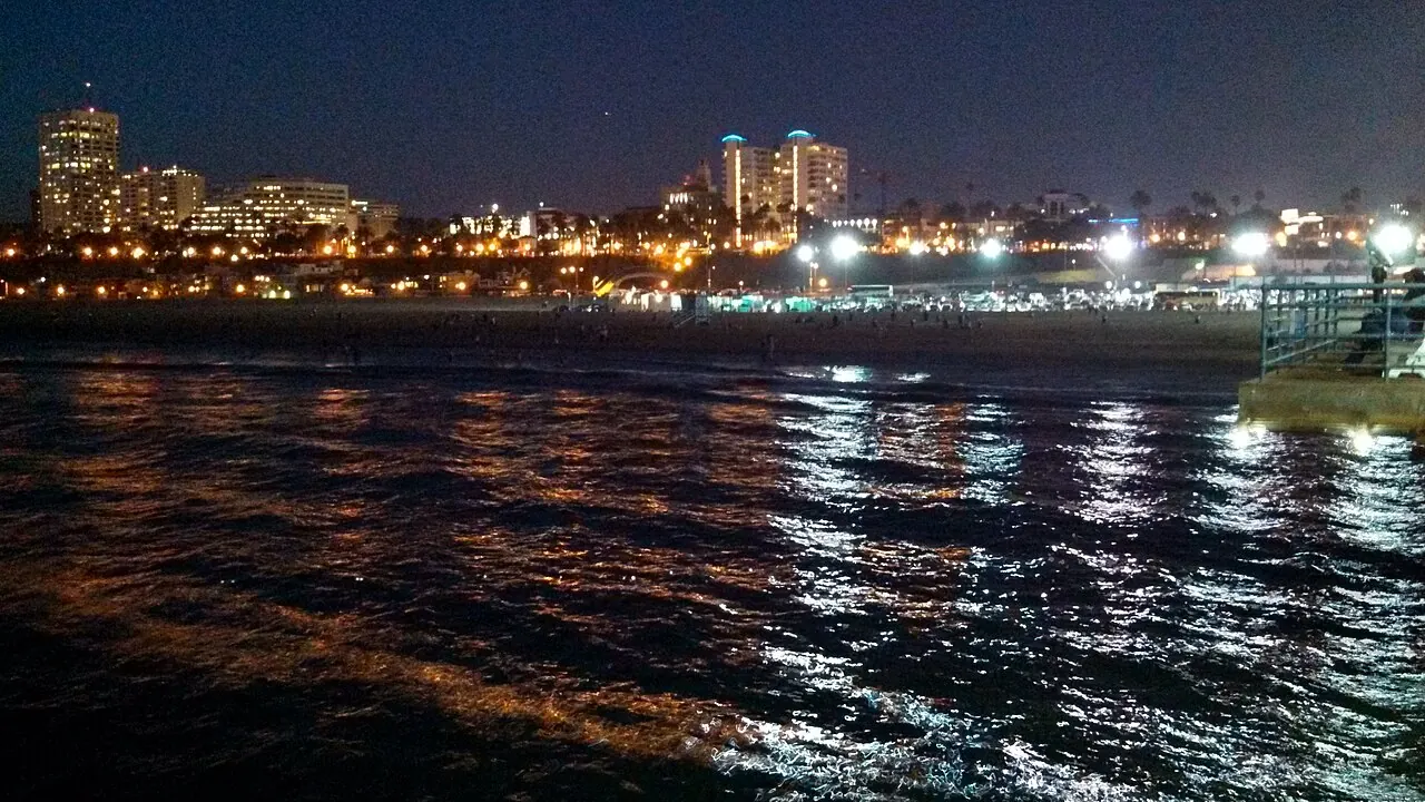
The 10 AM surf lesson (leave Pismo by ~7) and the 9 PM Hertz return at LAX. Gas up before driving to Griffith so the post-sunset run is a straight shot: leave the observatory by 7:50, Hertz by ~8:50, hotel shuttle after. Everything between the lesson and Griffith still lingers like a beach day should.
- 10–12
Surf lesson — Malibu Surfrider · ~$90
Wetsuit included — the water is ~69°F here, the warmest of the trip. Surfrider is a long, gentle, forgiving longboard break: the classic first-timer wave. Book for Aug 14; the school may shift to Zuma/Sunset Point for conditions.
- 12:30
El Matador State Beach
Sea-stack photos and steep stairs to the sand — just west of Surfrider, so grab it on the way in if easier.
- 1:30
- 2:30
Santa Monica — swim + beach + pier
THE swim stop: ~69°F water, lifeguarded, gentle. Pier, Pacific Park, the Route 66 sign — and actually get in the water. No flight to catch today, so stay as long as it’s fun.
- 4:30
Venice Beach Boardwalk
Skate park, Muscle Beach, street performers, and the canals two blocks in — a short hop south while you’re already sandy.
- 6:30
Griffith Observatory — Hollywood Sign at sunset · leave by 7:50
Free observatory, the Hollywood Sign view, the city lighting up at sunset (~7:45 PM). HARD STOP at 7:50 — the car is due at Hertz LAX by 9. Dinner near the hotel after the drop.
- Night 7
Return the car (~8:50), then hotel shuttle — El Segundo / Inglewood
Hertz LAX by 9 PM, tank already full, photograph the car and fuel gauge, then the hotel shuttle. The hotel must have an airport shuttle — you’re car-less from here. Pack tonight.
8Fly home
Sat Aug 15 · no car — hotel shuttle · DL2568 LAX 10:59 AM → SAT 3:59 PM
DL2568 departs at 10:59 AM. The car went back last night, so the morning is just the hotel shuttle (~8:30), bag drop, and Saturday-morning LAX security — airside by ~9 with two hours of margin. Bags packed from last night; this morning is pure execution.
- 7:30
Wake, breakfast, checkout
The car sweep happened at last night’s return. Receipts and the Fern Canyon permit make good souvenirs.
- ~8:30
Hotel shuttle to LAX
No car to return — it went back Friday at 9 PM. Confirm the shuttle time with the front desk tonight.
- ~9:00
Airside at LAX
Bags dropped, through security, snacks at the gate with two hours of margin.
- 10:59
DL2568 → San Antonio, lands 3:59 PM
Trip done — 8 days, ~1,550 miles, one mountain, one whole coast.
Reservations, cash, and trip triggers
The details most likely to change what fits.
Reserve and confirm
- URGENT: Ashford/Elbe room or campsite for Sat Aug 8
- URGENT: Hertz modification — pickup ~3:45 PM Aug 8, drop LAX ~7:30 AM Aug 15
- Rainier timed-entry rules for pre-7 AM Aug 9 (nps.gov)
- Fern Canyon reservation for Aug 11
- Reconfirm the Elkhorn Slough kayak — Aug 12, 3–5 PM
- Malibu surf lesson — Aug 14, 10 AM
- Rooms for all six remaining nights (see the booking tracker)
Carry and check
- ~$75 cash: Fern Canyon $12 + Pfeiffer $12 + kiosks, parking, and drive-thru tree
- Offline maps downloaded for Rainier, the Redwoods, and Big Sur before Day 2
- Caltrans QuickMap on the morning of Day 6
- Tide forecast for Hug Point, Thor’s Well, Secret Beach, and tide pools
- Layers + water for Paradise (5,400 ft); quick-dry clothes and a waterproof phone case for the kayak
- Rental toll policy and the full-tank return requirement
Cut first when late
- Day 1: Space Needle/Chihuly, then the Great Wheel — never Kerry Park.
- Day 2: Reflection Lakes and the Narada base path; weather = Myrtle Falls swap.
- Day 3: Sea Lion Caves and Sand Master Park.
- Day 4: Fern Canyon — the largest time sink, even reserved.
- Day 5: shorten Battery Spencer; the kayak is untouchable.
- Day 6: Sand Dollar/Jade Cove, the long lunch, and Morro Bay.
- Day 7: Venice, then Point Dume and El Matador.
Conditions that override the plan
- Official closure, fire, surf, tide, or weather warnings.
- 2026 Rainier timed-entry rules differing from the pre-7 AM assumption.
- A tour operator moving or canceling the kayak or surf session.
- Monterey Car Week traffic around Carmel and Big Sur.
- Fog obscuring a viewpoint — do not wait indefinitely.
- The 10:59 AM Aug 15 departure and its 7:30 AM rental return.
Recheck before travel: road work, trail access, permits, prices, hours, tides, wildlife patterns, and restaurant schedules can change. This page is Anudeep’s organized master plan; it is not a live conditions service.
Photo credits
Locally optimized copies of freely licensed Wikimedia Commons images.
- Pike Place Market, Visitor7, CC BY-SA 3.0; resized and converted to WebP. (Day 1)
- Haystack Rock and Cannon Beach from Ecola State Park, Joe Mabel, CC BY-SA 4.0. (Day 3)
- Samuel H. Boardman State Scenic Corridor, Dougtone, CC BY-SA 2.0; resized and converted to WebP. (Day 4)
- Golden Gate Bridge from Battery Spencer, Christoph Strässler, CC BY-SA 2.0. (Day 5)
- Bixby Creek Bridge, Ian McWilliams, CC BY 2.0. (Day 6 + hero)
- Santa Monica from the pier, Northwalker, CC0. (Day 7)


